MY TOWN
LATITUDINE 46°6’50″40N – LONGITUDINE 13°5’21″84E
Fagagna dal 2006 fa parte del Club dei Borghi più belli d’ Italia ed è situata nella zona collinare del Friuli Venezia Giulia, a 15 Km da Udine, 60 Km circa dal confine con la Slovenja e 80Km circa dal confine con l’Austria. Assieme alle 4 frazioni Madrisio, Battaglia, Ciconicco e Villalta conta circa 6.100 abitanti. La massima altitudine è di 266 m e il punto più basso è a 99 m sul livello del mare, con una superficie di 37,02 Kmq.
LATITUDE 46°6’50″40N – LONGITUDE 13°5’21″84E
Fagagna since 2006 is member of Club of the Most Beautiful Villages of Italy, is located in the hilly area of Friuli Venezia Giulia, 15 Km from udine, 60 Km from the border with Slovenia and 80 Km from the border with Austria. Fagagna wuth the four small villages Madrisio, Battaglia, Ciconicco and Villalta together has about 6.100 inhabitants. The maximum altitude is 266 meter and the lowest point is at 99 meter above sea level, with an area of 37.02 sq Km.
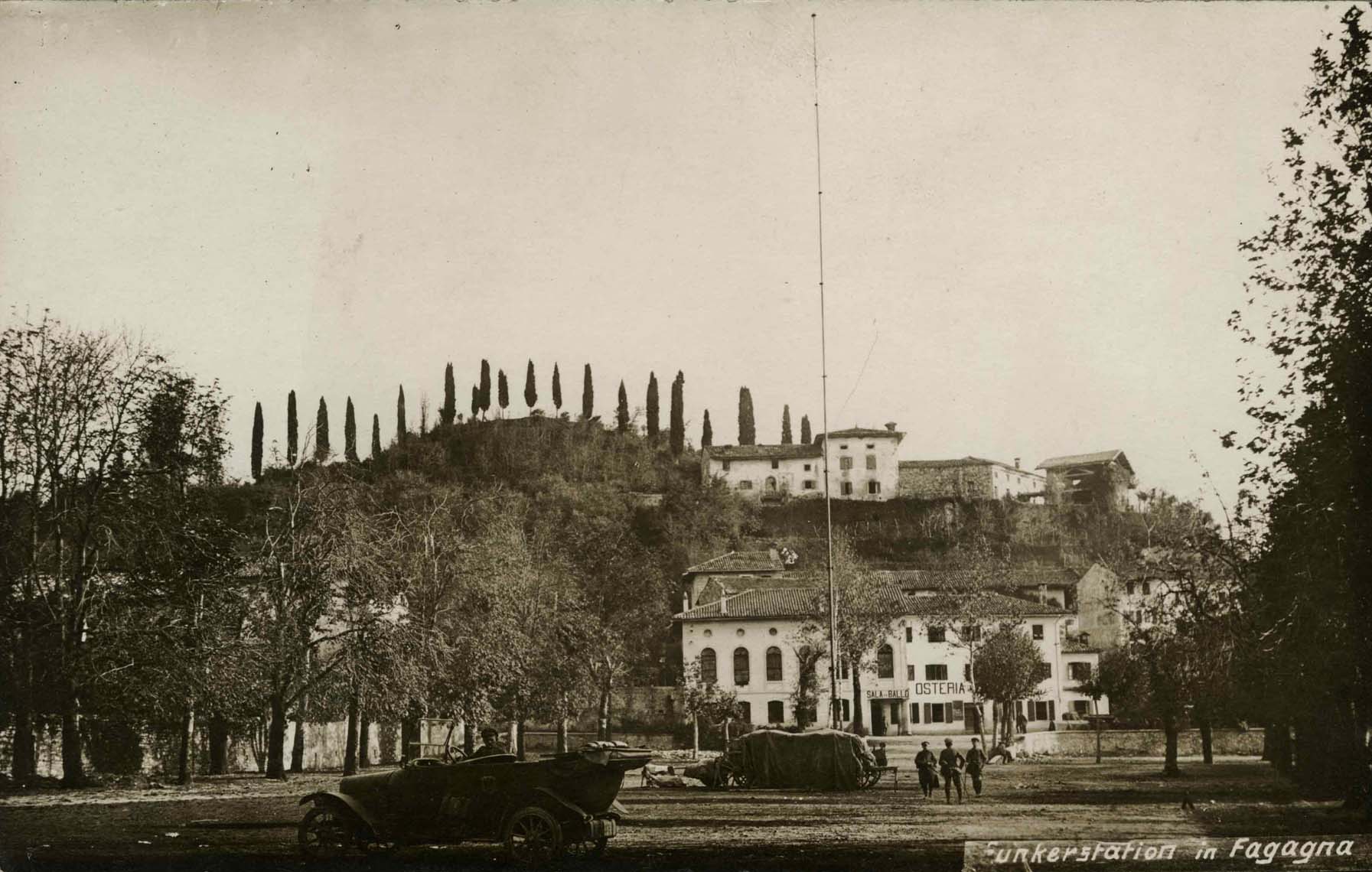
1° GUERRA MONDIALE
Una curiosità della prima guerra mondiale In questa fotografia si può vedere la Funkerstation di Fagagna, ossia la stazione telegrafica militare, che si trovava al centro del paese nell’ attuale piazza Unità d’ Italia durante la prima guerra mondiale. Al centro della fotografia si vede bene l’antenna verticale.
A curiosity of the first World War: In the picture you can see the Funkerstation of Fagagna, namely the military telegraph station, which was at the center of the village into actual Unità d’ Italia square. On the center of picture you can see the vertical antenna.